
CounterTerraRisk Solutions
CTRS Spatial
CounterTerraRisk Solutions
CTRS Spatial

CTRS Spatial provides drone-enabled surveying, modelling and inspection services for organisations that need accurate spatial data, clear visual evidence and usable reporting.
Using advanced aerial platforms and structured data capture methods, we help clients understand sites, assets and defects without unnecessary risk, disruption or delay.
We use aerial imagery, zoom capability, and thermal data, where appropriate, to support roof inspections, defect identification, asset condition reporting, storm damage assessment, solar panel checks, and reviews of inaccessible structures.
We plan and conduct structured drone flights to collect overlapping imagery and spatial data. This can support roof measurement, site mapping, progress records, terrain understanding and digital survey outputs.
Using DJI Terra, captured imagery can be processed into orthomosaics, 3D models, point clouds and digital surface outputs. These products help clients measure, visualise and understand physical environments without relying on isolated photographs.
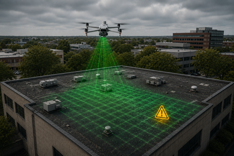
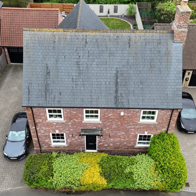
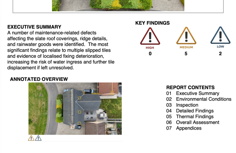
Drone roof inspections provide a safer, faster and more cost-effective way to assess roofs, gutters, chimneys, leadwork, solar panels and other difficult-to-access areas without the immediate need for scaffolding or roof access.
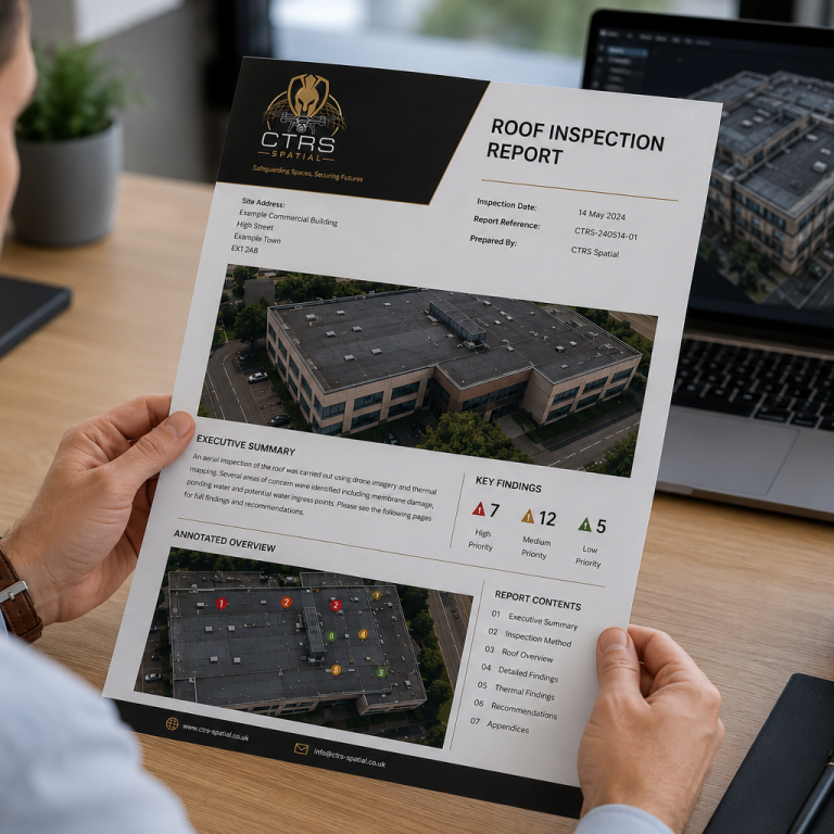
Using high-resolution aerial imagery, zoom capability and 3D modelling, CTRS Spatial can capture detailed visual evidence to support defect identification, condition reporting, maintenance planning and insurance-related assessments.
Our inspection reports can include annotated imagery, key findings, defect locations, supporting photographs and a clear summary of recommended next steps. Thermal imagery can also be used where appropriate to support the identification of heat loss, moisture indicators or insulation concerns.
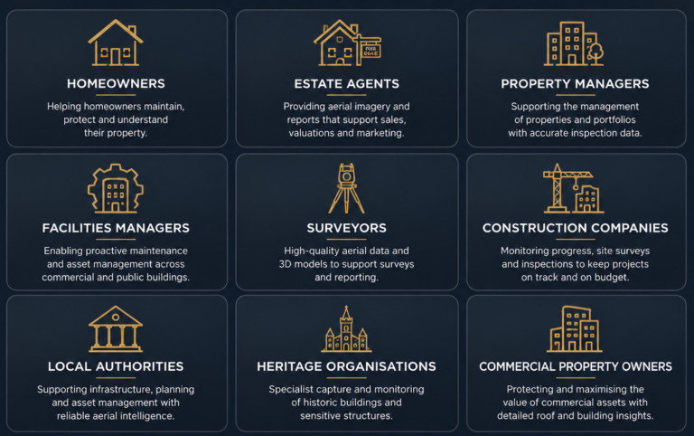
Suitable for homeowners, landlords, estate agents, property managers, surveyors and facilities teams.
We need your consent to load the translations
We use a third-party service to translate the website content that may collect data about your activity. Please review the details in the privacy policy and accept the service to view the translations.